Flying low and fast in darkness is one of the most demanding tasks in aviation. There's no margin for error—your altitude buffer is gone, visual cues are minimal, and a single mistake can be catastrophic. Military pilots train extensively for low-level night operations, and even with advanced equipment, the workload is intense.
This guide covers the fundamentals of safe low-level night flying: how low you can go, how to avoid terrain, when to trust which instruments, and what night vision systems can (and critically, cannot) do for you.
Affiliate disclosure: This guide contains affiliate links. If you purchase through these links, SimTuts earns a small commission at no extra cost to you. We only recommend products we genuinely believe improve the flight sim experience.
Defining "Low-Level"
Low-level flight has no universal definition, but in military operations, it typically means flying below 1,000 feet AGL, and sometimes as low as 100-250 feet AGL for nap-of-the-earth (NOE) operations. At night, even 500 feet AGL dramatically increases risk compared to daylight operations at the same altitude.
The lower you fly, the less time you have to react. At 100 knots and 250 feet AGL, you're passing over ground features in seconds. If you miss a ridge or tower in your scan, there's no second chance.
Key principle: Low-level night flying is about risk management, not just altitude. Every factor—speed, weather, terrain complexity, equipment capability, and your own fatigue level—affects your safe minimum altitude.
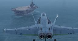
MC-130 preparing for low-level night operations - these missions require extensive planning and specialized equipment
Mission Planning: The Foundation of Safety
Low-level night operations are won or lost during planning. Unlike cruise flight where minor deviations are tolerable, low-level night flying demands precision route planning with multiple safety considerations.
Terrain Analysis
Study your route using high-resolution terrain data and charts. Identify:
- Maximum Elevation Figure (MEF) for each chart quadrangle
- Ridge lines and terrain features perpendicular to your track
- Transmission towers, wind turbines, and other vertical obstacles
- Minimum Safe Altitude (MSA) for segments of your route
In military operations, Emergency Safe Altitude (ESA) is calculated to provide at least 1,000 feet obstacle clearance in non-mountainous terrain and 2,000 feet in mountainous terrain within a 100-mile radius. For low-level night ops, apply similar logic to your tactical segments—know your escape altitude for every phase.
Weather and Illumination
Forecast requirements for low-level night operations:
- Visual Meteorological Conditions (VMC) or better
- Moon illumination prediction - full moon vs new moon dramatically changes visible horizon and terrain contrast
- Starlight availability - cloud cover reduces ambient light
- Visibility hazards - blowing snow, dust, or haze that reduce visibility
- Icing conditions - structural ice affects aircraft performance and can obscure vision systems
Even with night vision systems, you need minimum ambient light. A cloud-covered new moon creates near-zero illumination, making NVG use ineffective. Always have an abort plan for weather below minimums.
Route Construction
Build your route with safety margins:
- Avoid complex terrain - valleys and canyons reduce escape options
- Plan along terrain contours when possible—following valleys rather than crossing ridge lines
- Identify emergency landing sites at regular intervals
- Include go-around options at every critical waypoint
- Build in altitude buffers - if your planned altitude is 500 feet AGL, ensure terrain allows 1,000+ feet for maneuvering room
Altimeter Settings: QNH vs QFE vs Radar
Understanding and correctly setting your altimeters is fundamental. A mistake here will kill you.
Barometric Altimeter Settings
Your barometric altimeter measures atmospheric pressure and converts it to altitude. The setting you use determines what altitude reference you're seeing:
QNH (Mean Sea Level): When set to QNH, your altimeter reads altitude above mean sea level (AMSL). On the runway, the altimeter shows the airfield's elevation above sea level. QNH is standard for most aviation operations.
- Advantage: Matches terrain elevation data on charts
- Disadvantage: Airfield elevation above sea level may be high; you need to calculate clearance above ground level (AGL) mentally
- Critical for: Terrain clearance over variable terrain
QFE (Airfield Elevation): When set to QFE, your altimeter reads zero on the runway—it shows height above the airfield. This is popular in military operations and some European countries.
- Advantage: Immediate height above ground at your departure/arrival airfield
- Disadvantage: Useless for terrain clearance away from the airfield; you must know ground elevations along your route
- Critical for: Local operations, circuit work, approach minima at home base
- Danger: Failure to appreciate QFE can result in CFIT (controlled flight into terrain) if you believe you're higher AGL than you actually are
QNE (Standard Pressure 1013 hPa/29.92 inHg): Used for high-altitude flight levels. Not relevant for low-level ops except in transition.
The Critical Importance of Updates
Atmospheric pressure changes constantly. A pressure change of 1 hPa equals roughly 27 feet of altitude error. If pressure drops 10 hPa since you set your altimeter and you don't update, you're 270 feet lower than your altimeter indicates.
At low level, this can be fatal. Update your QNH or QFE:
- Every 100 nautical miles laterally
- Whenever passing a reporting station that provides updated pressure
- Every hour minimum, even if stationary
- If you suspect pressure changes (weather front passage, temperature change)
Radar Altimeter: Your Low-Level Lifeline
The radar altimeter (rad alt) measures your actual height above ground using radio waves. It's the most reliable instrument for low-level flight.
How it works: The radar altimeter transmits radio pulses downward and measures the time until they bounce back. This gives you true height above the terrain directly below you—not affected by atmospheric pressure.
Advantages:
- Accurate regardless of pressure changes
- Shows actual clearance above ground
- Unaffected by barometric errors
- Essential for night/IMC low-level ops
Limitations:
- Only measures height above terrain directly below - doesn't see terrain ahead
- Ineffective over water (reads water surface, not sea level)
- Typical operating range: 0-2,500 or 0-5,000 feet AGL (aircraft-dependent)
- Can be affected by C-band wireless interference near cellular towers (new regulations addressing this in 2026)
- Terrain slope can cause misleading readings—overflying a ridge gives high reading, then drops suddenly as terrain falls away
Using Radar Altimeter Effectively:
Set a radar altimeter bug at your minimum safe altitude. If the rad alt drops below your bug, you've descended too low—initiate immediate climb.
Cross-check rad alt with barometric altitude:
- If both decrease together: you're descending
- If rad alt decreases but baro holds: terrain rising ahead (common when approaching hills)
- If rad alt increases but baro holds: terrain dropping away (descending into valley)
Use radar alt to supplement barometric altimeters, especially during low-level operations where situational awareness of ground proximity is critical.
Terrain-Following Radar (TFR)
Military aircraft like the F-111 and modern bombers use terrain-following radar systems that look ahead and command automatic climbs/descents to maintain a constant height above rising and falling terrain. Some systems connect to the autopilot and fly the aircraft hands-off at 200 feet AGL at 500+ knots.
For sim pilots: Few civilian flight simulators model TFR accurately. Even in DCS, TFR implementation varies by aircraft. Don't assume it works as advertised—test in safe conditions before relying on it.
Terrain Avoidance Radar: Scans horizontally to create a map-like display, allowing navigators to plot routes around higher terrain. This is distinct from terrain-following (which maintains altitude) and is more common in bomber/transport aircraft.
Night Vision Systems: Capability and Limitations
Night Vision Goggles (NVGs) or Night Vision Systems (NVS) amplify available light—moonlight and starlight—to make terrain visible at night. They've revolutionized military night operations, but they impose severe limitations that simulator pilots must understand.
How NVGs Work
NVGs use image intensifier tubes that amplify ambient light by factors of thousands. They convert near-infrared light (invisible to the naked eye) into visible green images. More expensive systems provide color or white phosphor displays.
What you gain:
- Ability to see terrain features, obstacles, and horizons in darkness
- Detection of other aircraft lights and ground references
- Improved spatial awareness compared to unaided night vision
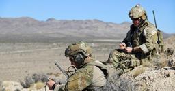
Pilot's view through night vision goggles - the characteristic green monochrome display with limited field of view
Critical NVG Limitations
Despite their capability, NVGs impose limitations that have caused numerous accidents, including a high-profile January 2025 collision at Washington Reagan National Airport where an Army Black Hawk on NVGs collided with a regional jet.
1. Narrow Field of View
NVGs provide only a 40-degree field of view—compared to roughly 200 degrees of human peripheral vision. This creates "tunnel vision."
Impact: You must actively scan to see what's beside or above you. Other aircraft, obstacles, or terrain features outside your narrow FOV are invisible. The 2025 Black Hawk accident highlighted this—investigators suspect the limited field of view prevented the Army pilots from seeing the regional jet.
2. Depth Perception Loss
NVGs reduce depth perception dramatically. The image is focused at a fixed distance (typically optical infinity), making objects appear further away than they are (Emmert's Law)—users overestimate distances.
Impact: Altitude judgement during approach and landing is degraded. Obstacles appear further away, increasing risk of collision. Wire strikes are a particular hazard—wires are nearly invisible, and distance estimation is unreliable.
3. Monochrome Vision and Contrast Dependency
NVGs show the world in monochrome (typically green), relying on contrast rather than color. Features with low contrast—like snow-covered terrain, fog, or obscurants—become invisible.
Impact: Hidden ridges, unseen obstacles, and terrain features that would be obvious in daylight disappear. Subtle terrain changes that rely on color differentiation vanish.
4. Blooming and Glare
Bright lights cause "blooming"—the image intensifier saturates, creating a white blob that obscures detail. City lights, airport beacons, and even bright moonlight reflecting off water can cause blooming.
Impact: Flying near cities or airports degrades NVG effectiveness. Flares or bright strobes render NVGs temporarily useless—you may need to look away or lift the goggles.
5. Weather Limitations
NVGs cannot see through clouds, fog, or precipitation. They amplify light, but if light can't penetrate the weather, there's nothing to amplify.
Impact: NVGs are ineffective in IMC. If you encounter instrument conditions at low level on NVGs, you must immediately transition to instruments and execute an escape manoeuvre—easier said than done at 250 feet AGL.
6. Physiological Effects
NVGs are heavy (often 1.5+ lbs on your helmet), cause neck strain, and distort your natural head position. Prolonged use leads to fatigue.
Impact: Plan for shorter mission durations than daylight ops. Factor in crew rest and fatigue management.
NVG Best Practices
If you're flying with simulated NVGs (DCS World supports this in some modules):
- Never fly faster than you can see - at low level, if terrain appears and you don't have time to react, you're too fast
- Scan aggressively - move your head constantly to overcome the limited FOV
- Use all available instruments - don't fixate on the NVG image; cross-check altitude, attitude, and navigation
- Avoid complex terrain - narrow valleys and ridge lines are far more dangerous on NVGs than daylight
- Respect weather minima - if visibility degrades, go IMC and climb immediately
- Plan for goggle failure - have a recovery procedure if goggles fail (climb, transition to IMC, RTB)
Workload Management: The Human Factor
Low-level night flying imposes massive cognitive workload. You're processing:
- Altitude (barometric and radar)
- Terrain clearance (constantly updating mental model)
- Navigation (staying on course in limited visibility)
- Aircraft control (attitude, speed, configuration)
- Threat awareness (if simulating combat operations)
- System monitoring (fuel, engine parameters, warnings)
Practical Workload Reduction Techniques
1. Automation Where Available
Use autopilot altitude hold and heading modes if available. Reducing manual flying workload frees brain capacity for navigation and terrain awareness.
2. Prepare and Brief
Chair-fly the mission before launching. Know every altitude, turn, and checkpoint. The more automated your decision-making, the more capacity you have for unexpected situations.
3. Crew Coordination
If flying multi-crew, divide tasks explicitly:
- Pilot flying (PF): aircraft control, altitude management
- Pilot monitoring (PM): navigation, radio calls, systems
- Clear crosschecks: "I show 600 feet radar, 1,800 barometric—confirm"
- Challenge incorrect actions immediately: "Altitude!"
4. Altitude Discipline
Set hard minimums and don't bust them. If your minimum is 500 feet AGL, treat 490 feet as ground level—immediate climb. No exceptions.
5. Recognise Fatigue
Night operations are exhausting. Fatigue impairs judgement, slows reactions, and increases error rates. Limit low-level night sorties to 1-2 hours and ensure adequate crew rest.
Get flight sim tips in your inbox
New guides, checklists, and tips. No spam. Unsubscribe any time.
Simulator-Specific Considerations
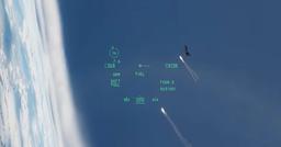
A cockpit view during low-level night operations — simulators can replicate the visual environment but not the full physiological challenge
Flight simulators can teach low-level night procedures, but they have limitations:
Visual Limitations
- Monitor limited FOV: Even with TrackIR or VR, you don't have true peripheral vision
- Depth perception: Monitor-based sims lack true depth cues; VR is better but still imperfect
- NVG simulation: Most sims apply a simple green filter—real NVGs have complex image artifacts, blooming, and noise
- Terrain detail: Simulator terrain may lack small obstacles (wires, towers, trees) that are critical at low level
Use Simulators To Practice:
Decision-Making: Route planning, altitude management, escape procedures Procedures: Altimeter setting, radar altimeter use, checklist discipline Crew Coordination: Communications, task division, crosschecks Degraded Conditions: Practice transitioning from NVG to IMC at low level
Don't Rely On Simulators For:
Physiological effects: NVG neck strain, fatigue, spatial disorientation True depth perception: Wire avoidance, approach judgement Realistic NVG performance: Blooming, contrast limitations, field of view
Checklist for Safe Low-Level Night Operations
Before launching:
- Route planned with MSA, MEF, and obstacle data
- Weather forecast confirms VMC, illumination, visibility
- Altimeter set to current QNH or QFE
- Radar altimeter tested and bug set
- Emergency escape plan briefed
- Fuel calculated with reserve for go-around
- Crew rest adequate (no fatigue)
- NVG/NVS checked and mission-ready (if applicable)
During flight:
- Update altimeter setting every 100 nm / 1 hour
- Cross-check radar alt vs barometric alt continuously
- Maintain altitude discipline—hard deck is sacred
- Scan aggressively—don't fixate on instruments or NVG image
- Call altitudes and terrain features aloud (crew coordination)
- Execute escape manoeuvre immediately if unsure of terrain clearance
Real-World Lessons for Sim Pilots
Low-level night flying in the real world has taught hard lessons. As a simulator pilot, you can learn from these without the cost:
1. Controlled Flight Into Terrain (CFIT) is the killer: More night accidents result from CFIT than any other cause. Altitude discipline and terrain awareness are non-negotiable.
2. Pressure errors kill: Every year, aircraft crash because pilots failed to update altimeter settings. Don't be complacent—treat altimeter setting as mission-critical.
3. NVGs are not magic: Over-reliance on night vision causes accidents. They're a tool with severe limitations. Respect those limitations.
4. Escape options save lives: The difference between an accident and a close call is often having a pre-briefed escape manoeuvre. Always have a "climb and RTB" option.
5. Fatigue is insidious: You won't notice your performance degrading. Limit exposure, plan rest, and brief crew to monitor each other for fatigue signs.
Conclusion
Low-level night flying is one of the highest-skill tasks in aviation. It demands precise planning, rigorous altitude discipline, comprehensive understanding of altimetry, respect for night vision system limitations, and relentless workload management.
Simulator pilots can develop the decision-making and procedural skills needed for safe operations—but always remember that simulators are training tools, not perfect representations of real-world risk. The margin for error at low level is zero. Treat every sortie as if your life depends on getting it right—because in the real world, it does.
A note on hardware: Low-level night flying is relentless scanning plus fine control with zero margin. Head-tracking — TrackIR 5, the Tobii Eye Tracker 5, or a VR headset like the Meta Quest 3 — lets you look into turns and across terrain without losing your control inputs, and a Thrustmaster T16000M FCS HOTAS with rudder pedals gives the smooth, coordinated handling that hugging terrain in the dark demands.
Further Reading
- Terrain-Following Radar (Wikipedia)
- Altimeter Setting Procedures (SKYbrary)
- Night Vision Imaging Systems (SKYbrary)
- NASA: Helicopter Flights with Night-Vision Goggles - Human Factors
- Use of Radio Altimeter (SKYbrary)
- Minimum Safe Altitudes (Boldmethod)
Fly safe, plan well, and respect the night.