You've received the 9-line, entered the coordinates, and your targeting pod is slaved to the point. There's something on the screen. But is it the right something?
Target correlation is the process of confirming that what you're about to attack actually matches what you've been briefed to attack. It's the last safety net between you and a blue-on-blue incident or an errant bomb hitting civilians. Get it wrong, and no amount of precision guidance will save you from the consequences.
This guide covers the purpose, methods, and procedures for proper target correlation in DCS World CAS missions.
Why Target Correlation Matters
Consider this scenario: You're tasked with hitting a T-72 platoon at grid GB 456 789. You enter the coordinates, your TGP slews to the location, and you see vehicles. Cleared hot. Bombs away.
But those weren't T-72s. They were friendly M1A2s that had pushed forward since the last intel update. Or they were civilian trucks on a nearby road. Or it was the right grid, but the target had already displaced 500 metres north.
Target correlation prevents these disasters by requiring you to positively confirm that:
- You're looking at the correct location
- What you see matches the target description
- Friendlies are where they're supposed to be (not where you're aiming)
- The tactical situation hasn't changed since the brief
In real-world operations, correlation failures have caused some of the most tragic friendly fire incidents in modern warfare. In DCS, they result in mission failures, server kicks, or that sinking feeling when you realise what you've done.
The Correlation Sequence
Target correlation follows a logical sequence. Work through these steps before every weapon release:
Step 1: Geographic Correlation
"Am I looking at the right place?"
This confirms your sensor is pointed at the correct location on the earth's surface.
Methods:
- Compare TGP coordinates with briefed coordinates
- Cross-reference with map features (roads, rivers, buildings)
- Verify distance and bearing from known reference points
- Check elevation matches the briefed target elevation
Common failures:
- Transposed digits in coordinate entry
- Wrong datum (coordinates not referenced to WGS-84)
- Sensor slaved to wrong waypoint
- GPS/INS drift on long missions
Practical check: If the briefed coordinates put the target at a road intersection, your TGP should be looking at a road intersection. If you're staring at an empty field, something is wrong.
Step 2: Target Description Correlation
"Does what I see match what I was told?"
The 9-line gave you a target description (Line 5). What you see through your sensor should match that description.
Methods:
- Count vehicles (briefed "platoon" means 3-4 tanks)
- Identify vehicle types (tanks vs. trucks vs. APCs)
- Confirm target activity (moving, stationary, firing)
- Match terrain features (treeline, compound, open ground)
Common failures:
- Similar-looking vehicles (T-72 vs. T-80 vs. friendly T-series)
- Target has moved or dispersed
- Multiple similar targets in the area
- Poor sensor conditions (weather, dust, smoke)
Practical check: If you're briefed "three T-72s in a treeline" and you see six trucks in the open, either you're looking at the wrong target or the situation has changed. Either way, don't release.
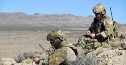
Step 3: Friendly Correlation
"Where are the friendlies relative to what I'm seeing?"
Line 8 of the 9-line told you where friendly forces are. You need to correlate this with your sensor picture.
Methods:
- Identify friendly positions relative to target
- Look for friendly markers (IR strobes, VS-17 panels, vehicles)
- Confirm attack heading keeps weapons effects away from friendlies
- Verify your impact point is on the correct side of the friendlies
Common failures:
- Friendlies have advanced since the brief
- Multiple friendly elements in the area
- Confusing "south of target" with "target is south"
- Forgetting that fragmentation travels further than the blast
Practical check: If friendlies are briefed 400m south, and you can see friendly vehicles through your TGP, they should be south of your target point—not under your crosshairs.
Step 4: Mark Correlation
"Does the JTAC's mark confirm my target?"
If the JTAC is marking the target (Line 7), use this to confirm you've found the right thing.
Methods:
- Observe smoke location relative to target
- Correlate laser spot with TGP (for laser-guided weapons)
- Match IR pointer to target location
- Time correlation (mark should appear when JTAC says "marking now")
Common failures:
- Wind blowing smoke away from actual target
- Wrong laser code entered
- Multiple laser sources in the area
- Delayed mark observation due to sensor lag
Practical check: When the JTAC says "laser on," you should see the sparkle appear on the target you're looking at. If it appears somewhere else, you're not looking at the same thing the JTAC is marking.
Correlation Methods by Aircraft
Different aircraft have different tools for correlation. Here's how to apply these principles in common DCS platforms:
A-10C II Warthog
The A-10C is purpose-built for CAS and has excellent correlation tools:
- TGP coordinates display: Compare with briefed grid
- Mark points: Store current TGP location and compare
- Buddy lase: Correlate your TGP with another aircraft's laser
- LST mode: Search for laser energy to confirm JTAC mark
Workflow:
- Enter coordinates into CDU as a waypoint
- Slave TGP to waypoint
- Use TMS forward to command point track
- Verify coordinates match (bottom of TGP display)
- Describe what you see back to JTAC
- Request mark and correlate
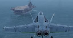
F/A-18C Hornet
The Hornet's TGP and weapons system provide solid correlation capability:
- WPDSG page: Verify waypoint coordinates
- TGP coordinates: Display on the FLIR page
- Laser spot tracker: AUTO mode searches for laser energy
- A/G radar: Ground map can confirm terrain features
Workflow:
- Set up waypoint with target coordinates
- Designate waypoint as SPI
- Slave FLIR to SPI
- Confirm coordinates on FLIR display
- Match target description visually
- Use LST for laser correlation
F-16C Viper
The F-16's systems are highly integrated for precision attack:
- Steerpoint coordinates: Verify in DED
- TGP cursor position: Displayed when over ground
- HSD: Cross-reference target location with friendlies
- Mark points: Store and compare positions
Workflow:
- Enter coordinates as steerpoint
- Select steerpoint as SPI
- TMS up to slave TGP to SPI
- Verify coordinates in TGP display
- Correlate description and friendlies
- Designate and confirm before release
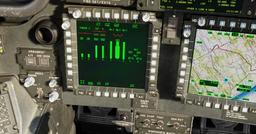
AH-64D Apache
The Apache's FCR and TADS provide unique correlation options:
- TADS video: Direct visual correlation
- FCR targets: Compare with briefed target types
- POINT page: Verify stored coordinates
- Cursor position: Displayed in TADS
Workflow:
- Enter target coordinates as a target point
- Slave TADS to stored point
- Visually confirm target description
- Cross-reference with FCR if applicable
- Correlate friendly positions via datalink
- Confirm with JTAC before engagement
Correlation Communication
Correlation is a two-way process between you and the JTAC. Here's how to communicate it:
The Target Description Readback
After finding what you think is the target, describe it back to the JTAC:
"Overlord, Hawg 1-1. I have three armoured vehicles in a treeline, oriented east-west. Confirm target."
This lets the JTAC confirm you've found the right thing—or correct you if you haven't.
The "Tally/No Joy" Call
When the JTAC asks if you have the target:
- "Tally target" — You see it and it correlates
- "No joy" — You cannot see or cannot correlate the target
Never say "Tally" unless you've completed correlation. Seeing something isn't enough.
Requesting Clarification
If correlation fails, ask:
"Overlord, Hawg 1-1. I see multiple vehicle groups in the area. Request talk-on."
The JTAC can then guide your sensor to the correct target using visual references.
The "Unable" Call
If you cannot positively correlate the target:
"Overlord, Hawg 1-1 is unable. Target does not correlate with briefed description."
This is always acceptable. An aborted attack beats a bad one.
Get flight sim tips in your inbox
New guides, checklists, and tips. No spam. Unsubscribe any time.
Correlation Failures: What to Do
When correlation fails, you have options:
Option 1: Request Re-Brief
The situation may have changed. Ask for updated information:
"Overlord, Hawg 1-1. Request updated target location. Current coordinates show no military activity."
Option 2: Request Talk-On
Have the JTAC guide your sensor visually:
"Overlord, Hawg 1-1. Request talk-on to target."
The JTAC will use terrain features and directions to walk you onto the target.
Option 3: Request Mark
If not already marking, ask for one:
"Overlord, Hawg 1-1. Request smoke on target."
Option 4: Abort
If you cannot correlate and the JTAC cannot help:
"Overlord, Hawg 1-1 is aborting. Unable to correlate target."
Aborting is never wrong when correlation fails. The ground forces would rather have no strike than a wrong one.
Practice Exercises
Build your correlation skills with these exercises:
Exercise 1: Coordinate Verification
In the mission editor, place several similar vehicle groups 500m apart. Practice slewing to coordinates and confirming you've found the correct group based on minor differences (vehicle count, orientation, terrain features).
Exercise 2: Talk-On Practice
Have a friend act as JTAC (they don't need Combined Arms—just the F10 map). They give you a rough area, then talk you onto the specific target using only verbal directions. No coordinates.
Exercise 3: Changing Situations
Create a mission where targets move. Practice re-correlating when what you see doesn't match the brief, and communicating the change.
Exercise 4: Friendlies in the Area
Place friendly units near targets. Practice identifying which group is which, and confirming your attack heading won't endanger friendlies.
Common Correlation Mistakes
1. Assuming the first thing you see is the target Just because something is near your coordinates doesn't make it the target. Complete the correlation sequence.
2. Ignoring description mismatches "Close enough" isn't good enough. If you're briefed tanks and you see trucks, stop.
3. Forgetting friendlies move The 9-line was current when it was given. Friendlies may have moved since then. When in doubt, confirm.
4. Over-relying on coordinates Coordinates get you close. Visual correlation confirms. Coordinates alone are not enough.
5. Rushing under pressure The JTAC is under fire and needs support now. But a rushed bad strike helps no one. Take the time to correlate.
The Correlation Mindset
The best CAS pilots develop an almost paranoid approach to correlation. They assume nothing. They verify everything. They would rather abort a strike than risk hitting the wrong target.
This mindset comes from understanding the stakes. In a simulation, a correlation failure means a failed mission. In reality, it means dead friendlies or civilians.
Treat every DCS mission as practice for the real thing. Build the habits now, and they'll be automatic when it matters.
Final Checklist
Before every weapon release, confirm:
- Geographic: TGP coordinates match briefed coordinates
- Description: What I see matches what I was briefed
- Friendlies: I can account for friendly positions
- Mark: JTAC's mark correlates with my target (if applicable)
- Gut check: Am I confident this is the right target?
If any box is unchecked, don't release. Re-correlate or abort.
The target will still be there in thirty seconds. The friendlies you might hit by rushing won't be.