All Approach Plates
Can You Read This Denver ILS 16R Approach Plate?
ILS·Denver International (KDEN)·RWY 16R·10 Questions·Premium
Denver International sits over a mile above sea level, which makes its approach plates look alarming until you realise the big numbers are just elevation. The ILS RWY 16R has a TDZE of 5326 ft, an 8100 ft MSA reflecting the terrain toward the Rockies, RNP-GPS initial legs, and a climbing missed approach. This quiz tests whether you can read a high-altitude plate without being fooled by the figures.
Study the plate, then answer 10 questions
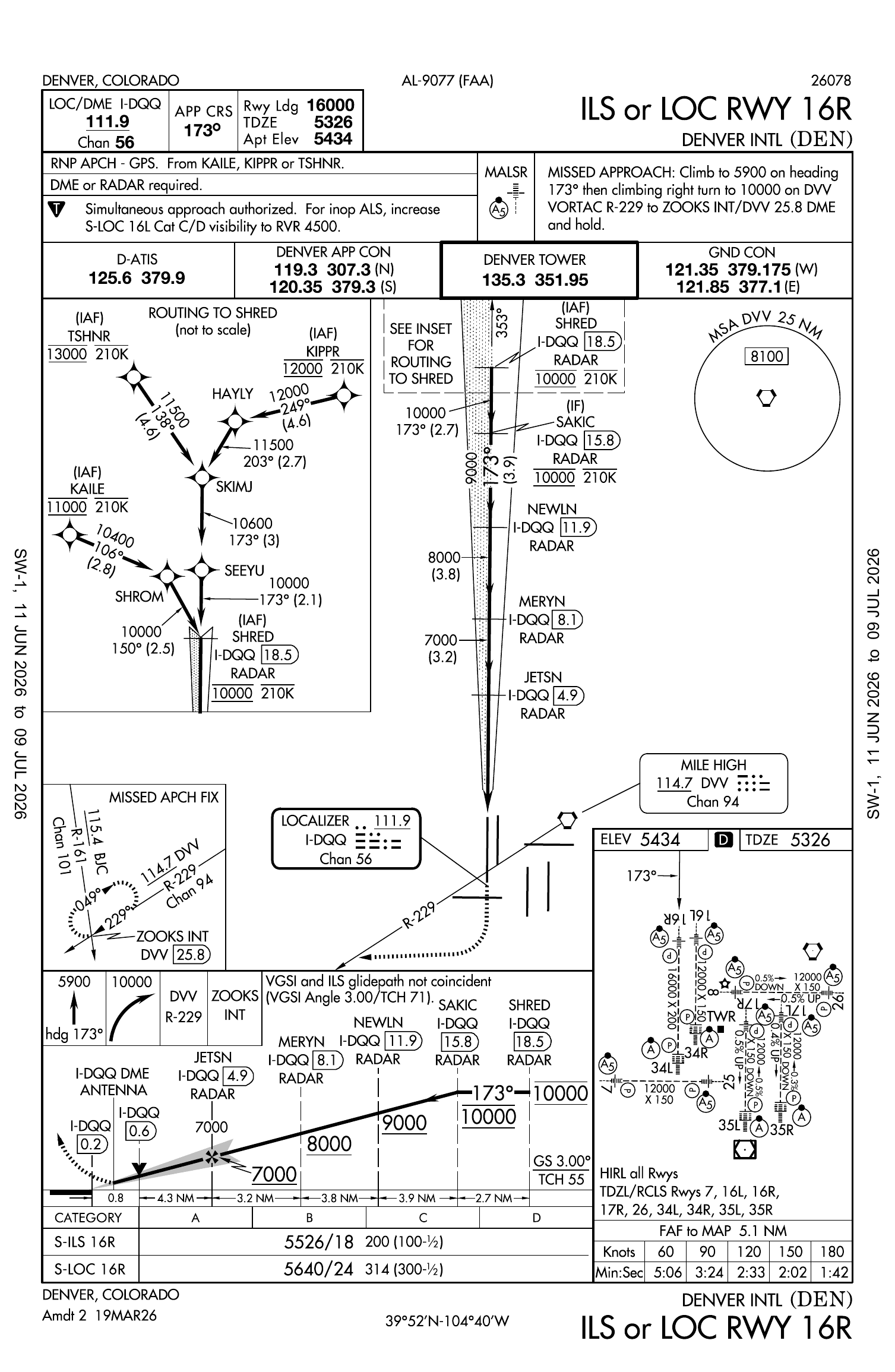
Pinch to zoom on mobile. Source: FAA AeroNav / UK AIP.
🔒
Premium Quiz
This approach plate quiz is available to SimTuts Premium members. Unlock all plates, your results history, and advanced MCDU scenarios.
Unlock with Premiumfrom £4.08/mo · cancel anytime
Try another plate
Need to learn how to read approach plates first?
Our guide breaks down every section of an approach plate: plan view, profile view, minimums, and the notes that matter.
Read the approach plates guide →